Permitted activities may vary within a park. Please confirm details with park staff.
Lafarge Meadows is a approximately 60 ha area located on the south side of Stoney Trail S.E., running parallel to the west bank of the Bow River. The area has a pathway joining the rest of the park from the boat launch staging area.
Formally, a gravel pit, Lafarge Meadows has been transformed into a wetland landscape. The transition from roughly 25 years of mining to the present park landscape is the result of collaboration and partnerships between the Alberta Government, the City of Calgary, Lafarge Canada Inc., industry and the private sector.
Storm water runoff from the surrounding neighborhoods fill the engineered wetlands of Lafarge Meadows. This runoff is contaminated with pollutants and sediment. These pollutants and heavier sediments settle to the bottom of the wetlands resulting in a cleaner outflow of water. This process helps maintain healthier and cleaner water flows to the Bow River.
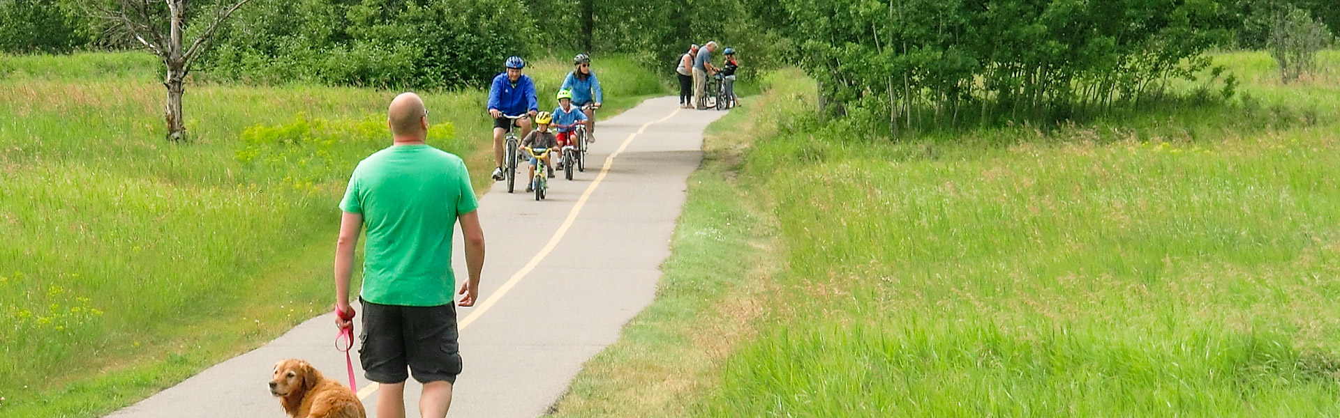
These wetlands are part of a large network of engineered wetlands in the park that provide habitat for diverse insects, birds, amphibians and mammals. Lafarge Meadows is a fantastic spot for walking and seeing local wildlife.
There are NO picnic tables at this site. Fires are NOT ALLOWED here.
Please Be Aware That:
The water is unsafe for swimming.
Water levels can fluctuate depending on the season and during inclement weather.
During cold periods the ice is unsafe for walking or skating.
Maps & Guides
Amphibians Fish Creek PP
Bankside Day Use
Bebo Grove Day Use
Boat Launch Day Use
Bow Valley Ranch Day Use
Burnsmead Day Use
Chinook Rotary Nature Park Day Use
Glennfield Day Use
Hulls Wood Day Use
Lafarge Meadows Day Use
Mallard Point Day Use
Shannon Terrace Day Use
Sikome Aquatic Facility Day Use
Votier's Flats Day Use
Glennfield Area Blackbird Group Use
Glennfield Area Aspen Group Use
Glennfield Area Crocus Group Use
Fish Creek Environmental Learning Centre SF
Sikome Aquatic Facility SF -- 140cd007-28d2-4bed-bfcf-e70171c53d99 True
Birds in the Park & Checklist Fish Creek PP
Bankside Day Use
Bebo Grove Day Use
Boat Launch Day Use
Bow Valley Ranch Day Use
Burnsmead Day Use
Chinook Rotary Nature Park Day Use
Glennfield Day Use
Hulls Wood Day Use
Lafarge Meadows Day Use
Mallard Point Day Use
Shannon Terrace Day Use
Sikome Aquatic Facility Day Use
Votier's Flats Day Use
Glennfield Area Blackbird Group Use
Glennfield Area Aspen Group Use
Glennfield Area Crocus Group Use
Fish Creek Environmental Learning Centre SF
Sikome Aquatic Facility SF -- 140cd007-28d2-4bed-bfcf-e70171c53d99 True
Burns Family Fish Creek PP
Bankside Day Use
Bebo Grove Day Use
Boat Launch Day Use
Bow Valley Ranch Day Use
Burnsmead Day Use
Chinook Rotary Nature Park Day Use
Glennfield Day Use
Hulls Wood Day Use
Lafarge Meadows Day Use
Mallard Point Day Use
Shannon Terrace Day Use
Sikome Aquatic Facility Day Use
Votier's Flats Day Use
Glennfield Area Blackbird Group Use
Glennfield Area Aspen Group Use
Glennfield Area Crocus Group Use
Fish Creek Environmental Learning Centre SF
Sikome Aquatic Facility SF -- 140cd007-28d2-4bed-bfcf-e70171c53d99 True
Park Visit Tips Fish Creek PP
Bankside Day Use
Bebo Grove Day Use
Boat Launch Day Use
Bow Valley Ranch Day Use
Burnsmead Day Use
Chinook Rotary Nature Park Day Use
Glennfield Day Use
Hulls Wood Day Use
Lafarge Meadows Day Use
Mallard Point Day Use
Shannon Terrace Day Use
Sikome Aquatic Facility Day Use
Votier's Flats Day Use
Glennfield Area Blackbird Group Use
Glennfield Area Aspen Group Use
Glennfield Area Crocus Group Use
Fish Creek Environmental Learning Centre SF
Sikome Aquatic Facility SF -- 140cd007-28d2-4bed-bfcf-e70171c53d99 True
Pathway MapFish Creek PP, Map, Trails, Stream Changes Trail,
Glennfield Area Blackbird Group Use
Glennfield Area Crocus Group Use
Glennfield Area Aspen Group Use
Bankside
Bebo Grove
Boat Launch
Bow Valley Ranch
Burnsmead
Chinook Rotary Nature Park
Glennfield
Hulls Wood
Lafarge Meadows
Mallard Point
Shannon Terrace
Sikome Aquatic Facility
Votiers Flats
Glennfield Area Blackbird
Glennfield Area Aspen
Glennfield Area Crocus
Fish Creek Environmental Learning Centre
Sikome Aquatic Facility
Fish Creek - Bow Valley Ranch Visitor Centre
Marshall Springs Pathway
https://albertaparks.ca/media/738464/fish-creek-tear-sheet.pdf -- 140cd007-28d2-4bed-bfcf-e70171c53d99 True
Pathway Snow Clearing MapFish Creek PP, Map, Trails, Stream Changes Trail, Snow clearing route,
Glennfield Area Blackbird Group Use
Glennfield Area Crocus Group Use
Glennfield Area Aspen Group Use
Bankside
Bebo Grove
Boat Launch
Bow Valley Ranch
Burnsmead
Chinook Rotary Nature Park
Glennfield
Hulls Wood
Lafarge Meadows
Mallard Point
Shannon Terrace
Sikome Aquatic Facility
Votiers Flats
Glennfield Area Blackbird
Glennfield Area Aspen
Glennfield Area Crocus
Fish Creek Environmental Learning Centre
Sikome Aquatic Facility
Fish Creek - Bow Valley Ranch Visitor Centre
Marshall Springs Pathway -- 140cd007-28d2-4bed-bfcf-e70171c53d99 True
Respecting Wildlife Fish Creek PP
Bankside Day Use
Bebo Grove Day Use
Boat Launch Day Use
Bow Valley Ranch Day Use
Burnsmead Day Use
Chinook Rotary Nature Park Day Use
Glennfield Day Use
Hulls Wood Day Use
Lafarge Meadows Day Use
Mallard Point Day Use
Shannon Terrace Day Use
Sikome Aquatic Facility Day Use
Votier's Flats Day Use
Glennfield Area Blackbird Group Use
Glennfield Area Aspen Group Use
Glennfield Area Crocus Group Use
Fish Creek Environmental Learning Centre SF
Sikome Aquatic Facility SF -- 140cd007-28d2-4bed-bfcf-e70171c53d99 True
Single Track Trail Map PamphletFish Creek PP, Map
Glennfield Area Blackbird Group Use
Glennfield Area Crocus Group Use
Glennfield Area Aspen Group Use
Bankside
Bebo Grove
Boat Launch
Bow Valley Ranch
Burnsmead
Chinook Rotary Nature Park
Glennfield
Hulls Wood
Lafarge Meadows
Mallard Point
Shannon Terrace
Sikome Aquatic Facility
Votiers Flats
Glennfield Area Blackbird
Glennfield Area Aspen
Glennfield Area Crocus
Fish Creek Environmental Learning Centre
Sikome Aquatic Facility
Fish Creek - Bow Valley Ranch Visitor Centre
Marshall Springs Pathway -- 140cd007-28d2-4bed-bfcf-e70171c53d99 True
Snakes in the Park Fish Creek PP
Bankside Day Use
Bebo Grove Day Use
Boat Launch Day Use
Bow Valley Ranch Day Use
Burnsmead Day Use
Chinook Rotary Nature Park Day Use
Glennfield Day Use
Hulls Wood Day Use
Lafarge Meadows Day Use
Mallard Point Day Use
Shannon Terrace Day Use
Sikome Aquatic Facility Day Use
Votier's Flats Day Use
Glennfield Area Blackbird Group Use
Glennfield Area Aspen Group Use
Glennfield Area Crocus Group Use
Fish Creek Environmental Learning Centre SF
Sikome Aquatic Facility SF -- 140cd007-28d2-4bed-bfcf-e70171c53d99 True
Spirit of the Old West Fish Creek PP
Bankside Day Use
Bebo Grove Day Use
Boat Launch Day Use
Bow Valley Ranch Day Use
Burnsmead Day Use
Chinook Rotary Nature Park Day Use
Glennfield Day Use
Hulls Wood Day Use
Lafarge Meadows Day Use
Mallard Point Day Use
Shannon Terrace Day Use
Sikome Aquatic Facility Day Use
Votier's Flats Day Use
Glennfield Area Blackbird Group Use
Glennfield Area Aspen Group Use
Glennfield Area Crocus Group Use
Fish Creek Environmental Learning Centre SF
Sikome Aquatic Facility SF -- 140cd007-28d2-4bed-bfcf-e70171c53d99 True
Willans Family Fish Creek PP
Bankside Day Use
Bebo Grove Day Use
Boat Launch Day Use
Bow Valley Ranch Day Use
Burnsmead Day Use
Chinook Rotary Nature Park Day Use
Glennfield Day Use
Hulls Wood Day Use
Lafarge Meadows Day Use
Mallard Point Day Use
Shannon Terrace Day Use
Sikome Aquatic Facility Day Use
Votier's Flats Day Use
Glennfield Area Blackbird Group Use
Glennfield Area Aspen Group Use
Glennfield Area Crocus Group Use
Fish Creek Environmental Learning Centre SF
Sikome Aquatic Facility SF -- 140cd007-28d2-4bed-bfcf-e70171c53d99 True
William Roper Fish Creek PP
Bankside Day Use
Bebo Grove Day Use
Boat Launch Day Use
Bow Valley Ranch Day Use
Burnsmead Day Use
Chinook Rotary Nature Park Day Use
Glennfield Day Use
Hulls Wood Day Use
Lafarge Meadows Day Use
Mallard Point Day Use
Shannon Terrace Day Use
Sikome Aquatic Facility Day Use
Votier's Flats Day Use
Glennfield Area Blackbird Group Use
Glennfield Area Aspen Group Use
Glennfield Area Crocus Group Use
Fish Creek Environmental Learning Centre SF
Sikome Aquatic Facility SF -- 140cd007-28d2-4bed-bfcf-e70171c53d99 True




 Electric Bicycles